By Maria Papagiannopoulou,
High Cup Nick, England’s Grand Canyon, is a 10.5-mile round hike that takes in the most stunning feature of the entire Pennine Range.
We hike up into a steep-sided valley with indications of previous mining all around, with some ruins to examine, after leaving the charming village of Dufton. As we climb higher towards the top of the Pennines, we come to a watershed, where one stream flows to the Irish Sea and the other flows to the North Sea via the Tees. We move slowly downstream, with views over vast moorland territory, as we walk through muddy ground, following Rundale Tarn as it begins its trek to the North Sea. After a few miles, we arrive at the high point — High Cup Nick.
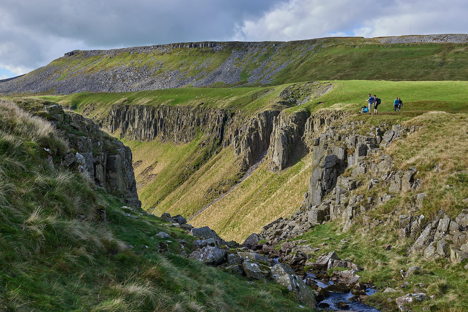
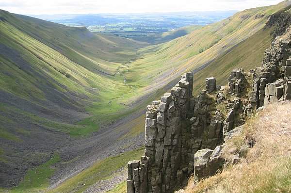
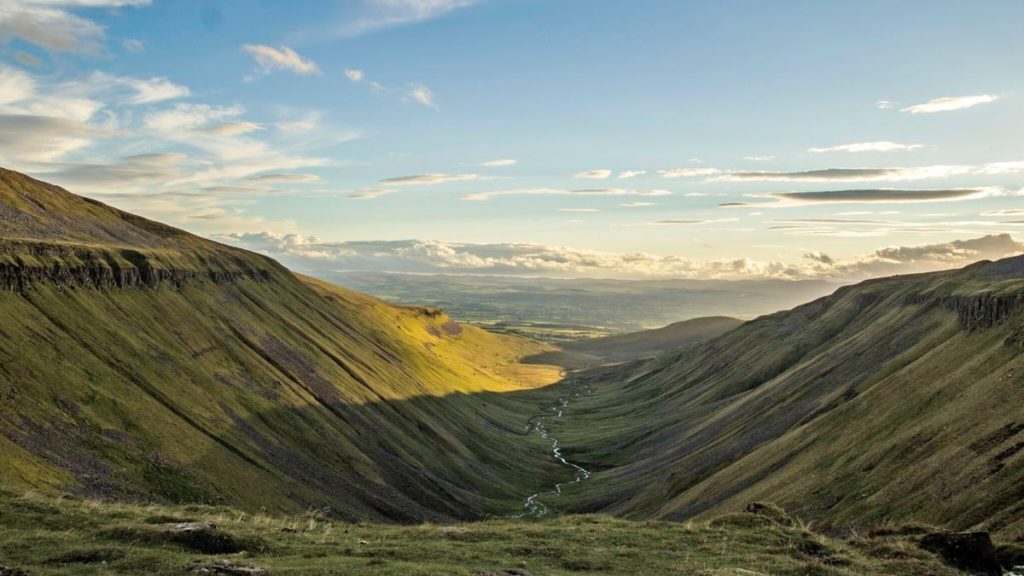
This famous nick, a stunning geological structure at the top of High Cup Gill, is part of the well-known Whin Sill and overlooks the best-glaciated valley in Northern England, and is a deep cleft on the Pennine fellside. The grey-blue dolerite crags, that make up High Force and Cauldron Snout, can be seen there. It is a wonderful sight to behold.
The valley is known as High Cup Gill by the Ordnance Survey, but it is also known as High Cup Nick, which refers to the point at the valley’s northeastern end, where the headwaters of Highcup Gill Beck pass from the relatively flat terrain of High Cup Plain over the lip of High Cup Scar into the valley. Gill is a Norse word that means narrow valley or ravine, while beck means brook; both are common in the hills of northern England.

It is considered one of the best natural features in northern England, as seen in the famous vista southwest over the valley into the Vale of Eden from its top at High Cup Nick. A near-horizontal outcrop of the Whin Sill, a late Carboniferous dolerite intrusion that underpins much of the North Pennines and northeast England, forms High Cup Scar. Under the scar, tumbling slabs of this granite are strewn throughout the scree slopes. Nichol or Nichol’s Chair is a prominent pinnacle of this rock on the northern side of the valley, named after a local cobbler who practiced his profession perched on its summit for a bet. The Alston Formation, which is part of the Yoredale Group comprising numerous layers of limestones, sandstones, siltstones and mudstones, is the country rock into which the sill is intruded.

Older rocks, however, completely covered by the dolerite blocks, can be found at the base of the gill: the sedimentary rocks.
The Pennine Way, which goes from Dufton east via Maize Beck and Cauldron Snout to Forest in Teesdale, surrounds the valley on its northern side by a traditional route known as “Narrow Gate”. This national trail separates into two independent routes on each side of Maize Beck; the southerly of the two leads via High Cup Nick. High Cup Nick has been described as a challenging 8-mile walk with an elevation of 1,445 feet and is listed in the 100 finest Pathfinder hikes in Britain. In his book, Pennine Way Companion (1968), legendary fellwalker, Alfred Wainwright, describes High Cup as “a fantastic moment of the trek”.
Dufton is a little community nestled between two of the Pennine Way’s most difficult sections. The highest areas of the hike have steep declines, and the helm wind sweeping through the valley may be very strong. Because the valley is entirely within an area designated as open land, under the Countryside and Rights of Way Act 2000, walkers have unrestricted access. Because this portion of the Pennine Way is a bridleway, bikers and horseriders are permitted to use it.
References
- High Cup Gill, wikipedia.org, Available here
- Grand Canyon of the North, duftonbarnholidays.co.uk, Available here


